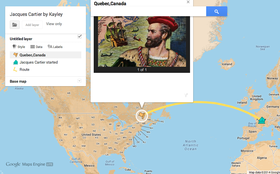
 Third graders in Ms. Remley’s class at Davis Elementary have been learning about the Explorers (SOL3.3). Today I showed them how to make their own interactive maps using Google Maps Engine. First I let them choose which explorer they wanted to research: Columbus, Cartier, Newport, or Ponce de Leon. Next they placed a marker on the country that sponsored their trip. I showed them how they could change the color of the marker or even the icon itself. We also created a pop-up label for the marker. The students wrote the name of the country and a sentence about the reasons for the voyage, then they added a picture to represent that country. They placed another marker on the final destination and added a similar pop-up label to it. They also drew a line to show the route the explorer took. I showed them how to change the color and size of the line. Finally they customized the look of their map and published it. I posted all their links to a Google Doc that you can take a look at here.

