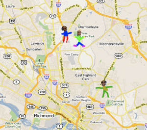
 Today Ms. Hall’s kindergarten class at Laburnum Elementary used Google Earth to locate their school. We even zoomed down so close that we could see the U.S. map on the blacktop! Next we tried to locate their houses. Ms. Hall has been working with them on memorizing their addresses, so this was a great way to practice. They would tell me their address and I would enter it into Google Maps and put a pushpin where they lived. Then they drew an icon of themselves in Pixie and we used those icons to replace the pushpin. So in the final map, you can see a picture of the student in the location where they live (click on the picture…I can’t show the embedded Google map because it has the addresses of students, but it’s an actual interactive Google map that you can click and drag and zoom and explore)!


