Submitted by: Jaime Brinkman
School: Ridge Elementary School
Summary
The purpose of this lesson is for second grade students to demonstrate their mastery of United States map features and apply this knowledge to a problem solving activity. Through this process, students will be encouraged to demonstrate creative thinking while using technology to demonstrate their understanding of the map. After discussing maps, the students are given the option to create their map using the application of their choice. They chose to use Pixie, posters, and a Map Maker website. The students worked together to decide what was important to include on the map and created a rubric to use to assess their projects.
TIPC Ratings
This lesson is Developing in Research and Information Fluency. Students acquired information through teacher lessons and used maps, books, and online resources to complete the project.
This lesson is Developing in Communication and Collaboration. Students worked in teacher-selected groups and used digital tools to communicate the information that they have learned about US Geography.
This lesson is Approaching in Critical Thinking and Problem Solving. The students selected the most appropriate digital tools and critical thinking and problem solving strategies to solve an authentic task. They also reflected on their critical thinking skills and discussed ways to use these skills in the future.
This lesson is Approaching in Creativity and Innovation. The students created meaningful original work within the assignment parameters. The teacher created opportunities for the students to synthesize their research, collaborate with their peers and apply critical thinking skills to address an authentic task.
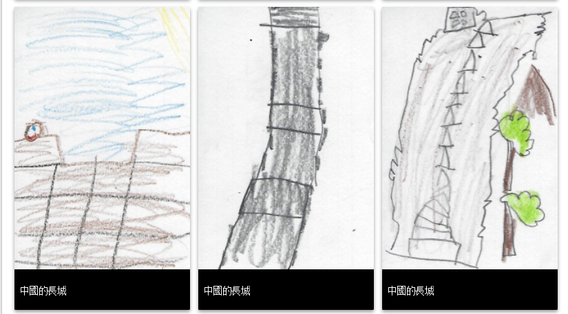
Student Artifact