This lesson is for : Grade 6:
Summary
Do you want students to go back in colonial times virtually? The Colony Project provides students with an interactive, engaging way to participate and immerse themselves into the history that surrounds the colonization of North America. Students take on a persona in one of the diverse social classes of colonial America, research and create a life for their person, and interact within their class “town” in the decision-making and building process. Students create homes, shops, maps, town newspapers, and town government that are unique to them based upon their research. The final project is a collaborative, interactive town map that displays each student’s reflective colonial journals and house projects. Each town/class evaluates other towns at the culmination of the unit, comparing and contrasting the similarities and differences that make them unique socially and geographically. *Project begins on Day 7 in the Instructional Planner.
TIPC Ratings
Research & Information Fluency
Rating: Approaching – Explanation: The students based their own research on their created persona. Students assembled and organized their research based on the social historical needs using historical databases of real-life people to lead them in an appropriate direction when developing their person. Students were given a lesson earlier in the year about good research strategies which they used this prior knowledge in their research they conducted. Students used Google Drive to assemble information. In the end students uploaded their construction based on their research to a class Thinglink which allowed for others to interact with the information.
When creating their class town, students led the discussion and debate for determining their geographical location based on information learned in class about the areas.
Communication & Collaboration
Rating: Ideal – Explanation: Students organized randomly in a variety of social groups and established a base line for their operations based on the individual need of the town. Students assumed specific roles based on decisions of the town (authentic task) and used Google Drive and Edmodo to collaborate, reflect, and share information.
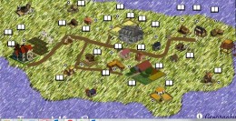
At the culmination of the project, student will upload individual artifacts to class’s map on Thinglink. Teacher will take each class’s town map and uploaded them to a Colonial Map hyperlinking all class’s towns together to be viewable by all students. Using Thinglink.com allows for students to interact with another class’s towns which they reflect on their town after evaluating another class town project using a Google Form.
Critical Thinking & Problem Solving
Rating: Approaching – Explanation: The teacher will initiate the main problem and goal of the development of their settlement and their main tasks in creating their town. Determining the plan on how to solve the main problem and develop the town was how students utilized their critical thinking skills.
Students will participate in a variety of authentic tasks such as town meetings, map making, finding homes/sponsors for slaves/indentured servants and developing additional needs for their town.
Creativity & Innovation
Rating: Ideal – Explanation: Students will participate in an authentic task to create a small colonial settlement by taking on the role of a colonists participating in the creation of the town, laws, name, design and interacting with their peers in the decision-making process. Students use knowledge to generate these original products which summarizes and exhibit their persona’s colonial life inside the parameters of their virtual town. Students work as a class and individually to take risks to create houses/shops that go along with their persona that include historical elements based from their research. Classes will evaluate other groups towns using this Google Evaluation Form and compare and contrast the differences and similarities between towns socially and geographically.
Students were promoted to take risk and use whatever digital platforms (Google Drive, Sketchup, Minecraft, Adobe Photoshop, PowerPoint, Autodesk Homestyler, Roomstyler) they choose to design items such as; houses, journals, newspapers, and a town map. All individual items will be uploaded and tagged to a digital copy of the town map using ThingLink.com. ThingLink.com allows the picture to become an interactive map of the student’s creation of their artifacts (journals, houses, newspaper).
The teacher will take each class’s virtual town and upload them to a Colonial Map hyperlinking all class’s towns together to be viewable by all students. Using Thinglink.com and Google Drive allows for students to interact with another class’s towns which they reflect on their town after evaluating another class town project using a Google Form
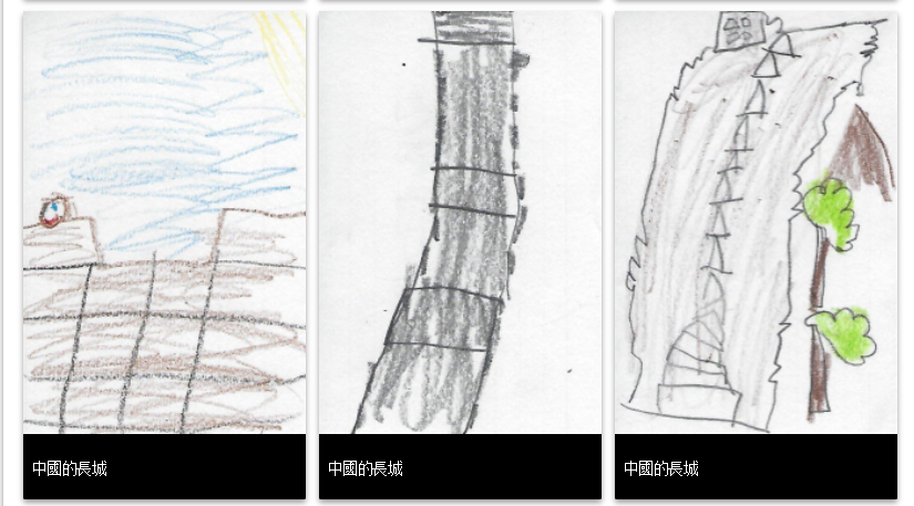
Student Artifact
Lesson Materials